Do you know about natural disasters?
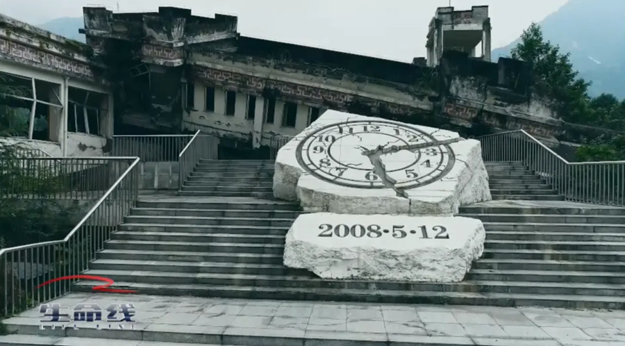
Earthquakes, mountain torrents, mudslides, typhoons, floods, blizzards, forest fires … … These natural disasters happen every year. When a serious disaster comes, it will destroy a city in an instant and make many people lose their homes, even their relatives.
May 12, 2023 is the 15th National Disaster Prevention and Mitigation Day. The theme of this year is "Preventing disaster risks and escorting high-quality development". Since the 18th National Congress of the Communist Party of China, China has put forward a series of new ideas and concepts on disaster prevention, mitigation and relief. The Opinions of the Central Committee of the Communist Party of China and the State Council on Promoting the Reform of the System and Mechanism of Disaster Prevention, Mitigation and Relief put forward that "to promote the reform of the system and mechanism of disaster prevention, we must firmly establish the concept of disaster risk management and comprehensive disaster reduction, adhere to the combination of prevention first, prevention and rescue, adhere to the unity of normal disaster reduction and abnormal disaster relief, and strive to realize the transformation from focusing on post-disaster relief to focusing on pre-disaster prevention".
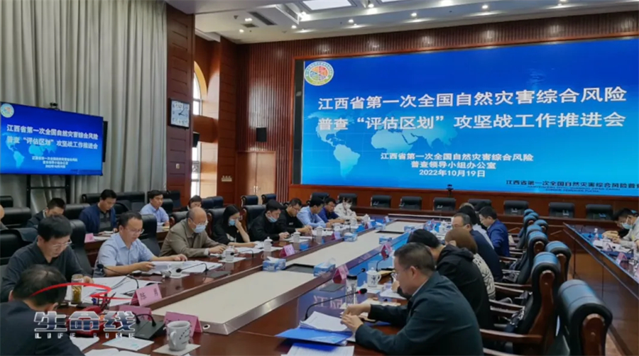
In order to find out the hidden dangers of natural disasters in various parts of China, the first national comprehensive risk survey of natural disasters will be carried out in 2020 with the consent of the State Council. In three years, with the participation of nearly 5 million professional and technical personnel from various regions, the nationwide census has achieved initial results.
From 2020, reporters from Lifeline went to Fujian, Jiangxi, Shandong, Zhejiang and other places for follow-up reports. On May 12th and 13th, two episodes of National Disaster Prevention and Mitigation Day special program "Data Empowering to Protect Peace" will be broadcast continuously in the Lifeline column of CCTV-12.
Take precautions and be precise first.
Arrange emergency equipment so that the distress information is no longer blocked.
Fujian province is surrounded by mountains on three sides and faces the sea on one side. There are many kinds of natural disasters and they are prone to occur frequently. Once disasters occur, the disaster situation should not be underestimated.

Typhoon, rainstorm, flood, mountain torrents and mudslides, as coastal areas, more than 30 coastal counties in Fujian Province are frequently affected by marine disasters. Villagers have lived here for generations. How to prevent disasters to make them live and work in peace and contentment?

Since the first national comprehensive risk survey of natural disasters was carried out, the emergency department has collected and adopted the data of all the population and housing disaster-bearing bodies in 33 coastal counties, investigated and summarized the historical data of disasters, and calculated the elevation of coastal seawalls in the whole province with reference to relevant data, so as to help the staff to divide the dangerous areas more accurately and let the people prepare for danger avoidance in advance.

In addition to marine disasters, flood waterlogging caused by heavy rain is also one of the major natural disasters faced by Fujian Province. Whenever the flood season comes, typhoons are swept by heavy rain. The flash floods caused by heavy rain will not only endanger the safety of villagers’ lives and property, but even more frightening is that some remote villages will be lost, and rescue work cannot even be carried out.

In order to solve this problem, the Fujian Provincial Party Committee and the provincial government equipped 3,550 high-risk areas and villages with high-risk mountain torrents with satellite phones. The emergency satellite phone has both mobile and fixed terminals, and the system has its own satellite search function, which can be used in bad weather and without public network. Through this census, satellite phones have been accurately put into every remote and high-risk village, effectively solving the problems of difficulty in asking for help and being rescued in these areas. Not only that, Nan ‘an, Quanzhou, which is located in the southeast coast, is affected by extreme weather all the year round. After the first national comprehensive risk survey of natural disasters was carried out, Nan ‘an City set up a total of 2,259 broadcasting points. Based on the refined data obtained from the survey, in 2023, the city will add 43 community emergency broadcasting points, and extend to cover more than 50 natural villages in the city, achieving 100% coverage of administrative villages and communities in the city.
The smart emergency command platform issued an early warning at the first time.
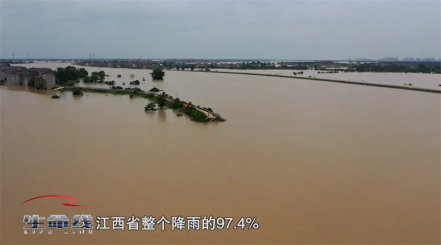
Jiangxi Province is one of the provinces suffering from serious natural disasters in China, with an average annual direct economic loss of more than 10 billion yuan. There are more than 2,400 rivers in the province, and the forest coverage rate ranks second in the country. Frequent natural disasters have a great impact on the production, life and economic development of local people.

The intelligent emergency command platform established by Ruichang Emergency Management Bureau according to the census data can grasp the dynamic information of every disaster-prone point in the city in real time, and monitor it in real time for 24 hours. Once the front is sensed, it can respond quickly and conveniently. Monitoring probes and infrared virtual railings are installed in 34 key waters in the city. Once someone approaches, they can be persuaded to leave by shouting.

On January 20, 2023, Ruichang Smart Emergency Command Platform issued an alarm, and abnormal temperature appeared in Hongyandong Scenic Area. The induction system quickly captured the fire point and uploaded screenshots to the platform. Hongyandong is a place with steep mountains and dense forests, so it is very difficult to put out the fire. There have been many fires in this place in history, and the shortest fire extinguishing time takes 3 days.

However, in this fire, under the command and dispatch of the intelligent emergency command platform, the fire was put out within ten hours. This efficient response made the local people really feel the sense of security brought by the census data.
From 2020 to 2023, the first national comprehensive risk survey of natural disasters lasted for three years. In view of 23 kinds of disasters in six categories, such as earthquakes, geology, meteorology, floods and droughts, marine, forest and grassland fires, people’s governments at all levels in provinces, cities and counties set up census leading groups, formulated plans and formed teams, comprehensively found out the hidden danger base of national disasters, identified the disaster resistance ability of key areas, and objectively understood the comprehensive risk level of disasters in the country and regions. The first national comprehensive risk survey of natural disasters has entered the stage of evaluation and zoning, and the data of the future survey will be better applied.
